From the journal

The Palong Tsangpo: A River Fed by Snow and Ice

From its source area in Baxoi County, Chamdo, the Palong Tsangpo crosses into Bomi and continues toward the Yarlung Tsangpo. A 2023 hydrology model quantifies the upstream catchment’s seasonal mix of rain, snowmelt, glacier melt and baseflow.

In the same city · Nyingchi ↗
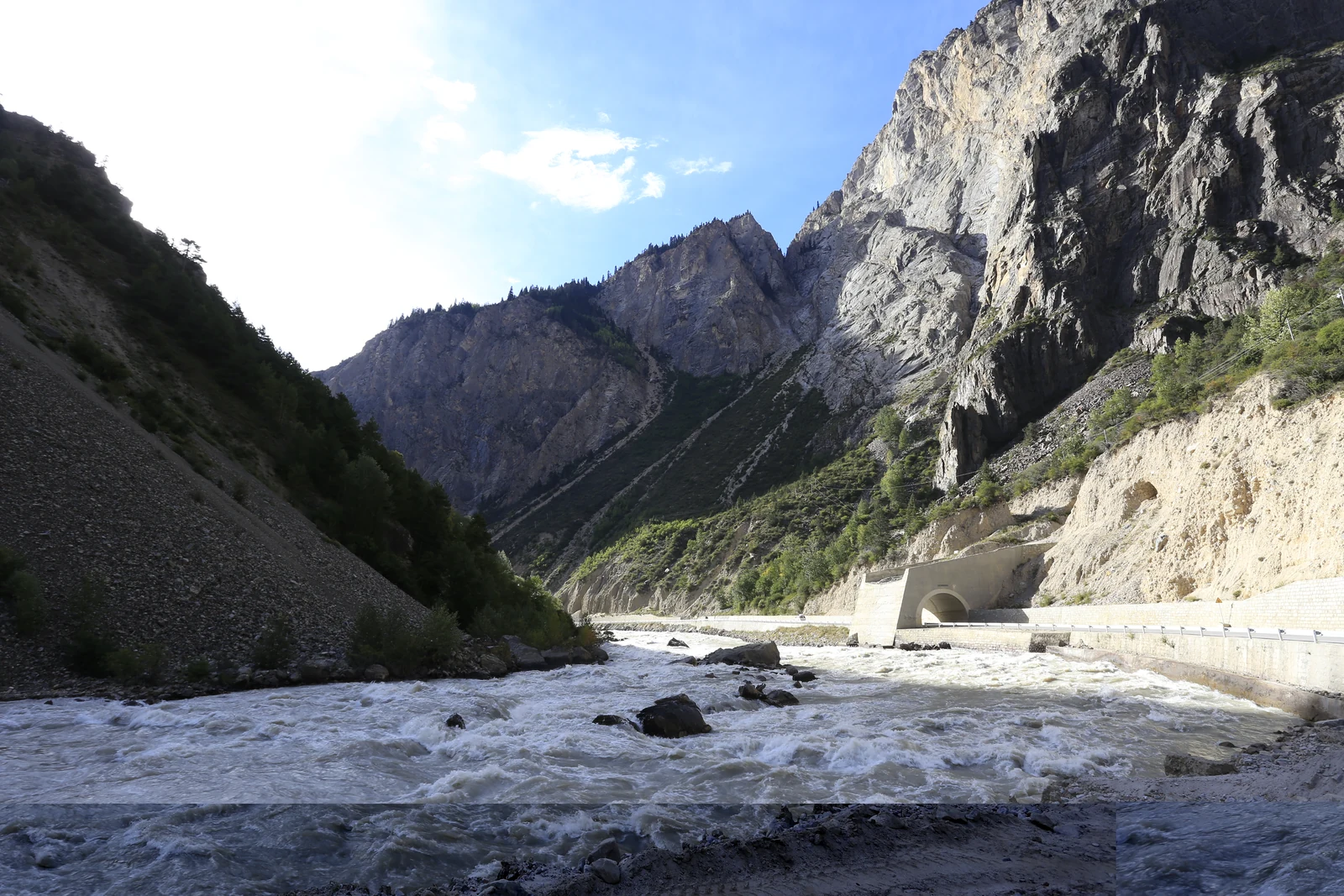
A fast mountain river runs below steep slopes beside a highway tunnel.
The Palong Tsangpo beside the highway in eastern Yupu Township, Bomi County.

Its headwaters are in Baxoi

The Palong Tsangpo belongs to more than one county story. Tibet’s water-resources department describes it as beginning at the terminus of an ice tongue on the northern slope of Azha Gongla Mountain, in Ranwu Township, Baxoi County, Chamdo. From that source area the river crosses into Bomi County in Nyingchi and eventually joins the Yarlung Tsangpo. The department’s basin profile gives a total channel length of 563 kilometres and an elevation drop of 3,360 metres; it lists Songzong Tsangpo, Bodui Tsangpo, Yigong Tsangpo and Layuequ among its principal tributaries.

Those administrative boundaries matter. Ranwu Lake and Laigu Glacier belong to Baxoi, Chamdo, even though the river later becomes central to Bomi’s landscape. A river can connect places without making them interchangeable. From the headwaters in Baxoi, the Palong Tsangpo continues downstream through Bomi before joining the Yarlung Tsangpo.

Four sources of upstream flow

A 2023 study by researchers from the Tibet Hydrology and Water Resources Survey Bureau and Beijing Normal University modeled runoff in the upper Palong Tsangpo basin. The paper reports that its model was calibrated against monthly discharge, remotely sensed snow cover and measured glacier runoff, with Nash–Sutcliffe efficiency scores of 0.95 for calibration and 0.94 for validation. For the study area and its modeled period, it estimated the total runoff contributions as 45 percent glacier melt, 25 percent snowmelt, 10 percent rainfall runoff and 20 percent baseflow.

The paper also identifies a seasonal rhythm: glacier melt contributed its largest share in July and August, while snowmelt was most important from April through June. These are model results for the upstream study basin, not measurements for every village or the entire 563-kilometre river. Their value is to show that the river’s water has more than one source, and that the mix shifts through the year.

Reading the landscape without flattening it

In Bomi, the Palong Tsangpo travels through a valley region where glaciers, tributary streams, forested slopes and settlements meet. The water bureau’s 2017 basin profile notes the main tributaries and places field inspections at Laigu and Ranwu upstream, Midui Glacier and Yigong Tsangpo in Bomi, and a tributary near Dongjiu. The sequence gives a field-based sense of the catchment’s scale: a river system assembled from different valleys, not a single glacier outlet.

A glacier-fed river can shape the setting in which forests and villages sit, but the available sources do not assign one forest stand to one glacier or provide a current ecological survey along the channel. Long-term glacier loss and short-term seasonal runoff are also different questions. The 2023 model warns that glacier runoff may decline over longer periods; it does not predict a date when a particular community will run short of water. The river is best read here as a changing network whose headwaters, tributaries and downstream valleys each need their own observations.

Continue exploring · Parlung Tsangpo ↗
Photo credits and rights
  1. The Palong Tsangpo beside the highway in eastern Yupu Township, Bomi County.Zhangzhugang · Creative Commons Attribution-ShareAlike 3.0 Unported Photo source ↗ Rights information ↗