A city wall can look like a boundary drawn around a finished city. Nanjing’s asks you to reverse that assumption: the terrain helped draw the boundary. Its surviving stretches turn beside water and rise along hills rather than completing a neat rectangle. Near Xuanwu Lake, compare the hard line of masonry with the open water. Toward Purple Mountain, think of the slopes as part of the defensive arrangement, not scenery added behind it. The useful question is not simply how high the wall stands, but what an approaching army would have had to cross before reaching it.
Nanjing
Nanjing’s Wall: A Landscape Built from Names
Read Nanjing’s city wall through its irregular geography, layered gateways and the people recorded in its bricks.
In the same city · Nanjing ↗A wall that refuses the rectangle
Four enclosures, different kinds of power
Construction began under Zhu Yuanzhang in 1366, before he founded the Ming dynasty. The larger capital project contained four nested kinds of enclosure: palace city, imperial city, capital city and outer city. The famous surviving wall chiefly belongs to the capital-city circuit. This distinction matters. It separated an urban population from the outside while further boundaries organised access to the ruler within. A map of those enclosures describes political distance as well as physical distance. Reading the wall only as a military object misses its role in defining what a capital was.
At Zhonghua Gate, read the space between walls
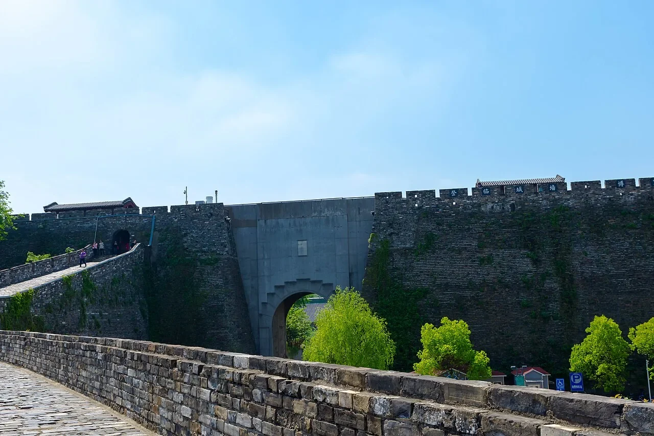
Zhonghua Gate, originally Jubao Gate, makes defence three-dimensional. The Qinhuai’s inner and outer waterways lie around its setting; inside the gate system, successive barbicans create enclosed spaces between barriers. Notice the repetition of openings rather than looking only for a single grand façade. Three barbicans and four gateways turn entry into a sequence. Ramps and vaulted spaces reveal a building designed for movement, storage and control. Imagine the difference between passing through one doorway and crossing an entire defended compound. The often-repeated treasure-basin story belongs to the gate’s folklore; the official historical explanation connects the older name to the hill it faced.
A brick can be an administrative document
Now bring the scale down from a gate to a single brick. Many wall bricks bear places, names and official responsibilities. These were not decorative signatures: they made production traceable. A defective batch could be connected to those who supplied or supervised it. Look for differences in the lettering. Some inscriptions were moulded, some stamped, others scratched into the unfired clay. Uniform construction depended on many hands, and the marks preserve traces of that distributed work. Even without reading every character, you can distinguish a carefully organised text from a shorter or less regular impression. The emperor ordered the wall; the bricks disclose a much larger cast.
The surviving line is not the complete past
Today the circuit survives in sections, not as an untouched, continuous enclosure. Breaks, repairs and changed surroundings should therefore be read as evidence rather than mentally erased. Compare where the masonry meets a park, a road or a watercourse. Each meeting shows a different accommodation between an inherited structure and a growing city. The old defensive edge has also become a place for ordinary public life. That reversal is part of its history: a boundary intended to restrict passage now helps people understand where they live. Hold the panoramic view and the individual inscription together. One reveals the strategic landscape; the other reveals how that landscape was made.