From the journal

From Galongla to Beibeng: Motuo in Nine Vertical Belts

On the road from the Galongla Tunnel to Beibeng, a few hours carry travelers from glacier country to banana groves, bamboo and fruit orchards.

In the same city · Nyingchi ↗
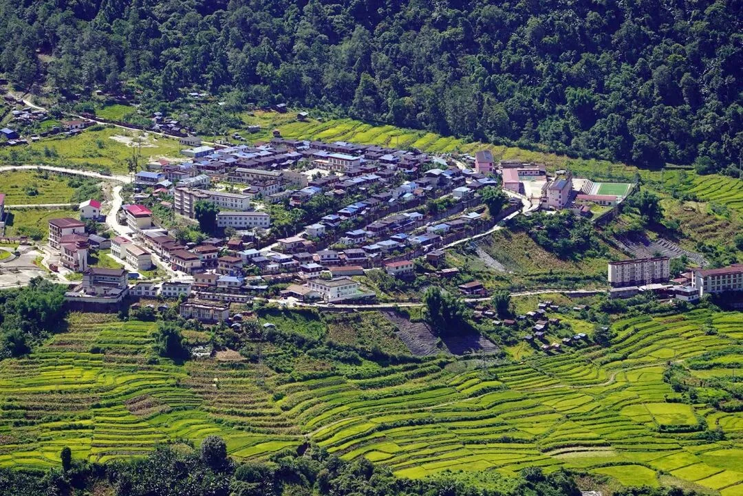
An elevated view of Beibeng Village, cultivated fields and forested valley slopes.
Beibeng Village’s cultivated fields in Motuo’s warm, low-elevation valley. This photograph shows the valley-floor endpoint, not the full Galongla-to-Beibeng elevation sequence.

A route through changing heights

The road from Bomi crosses the Galongla Tunnel at about 3,700 metres, then drops south toward Beibeng Township, below 1,000 metres. A 2023 route feature from the Nyingchi tourism bureau says the descent can be made in a few hours and describes it as a passage through Motuo’s nine vertical natural belts. The scale is easy to picture: a high tunnel above the clouds, then a long descent beside the Yarlung Tsangpo toward a warm river valley.

The municipal geography profile helps explain why the route changes so sharply. It records a regional relief of 7,627 metres between Nyingchi’s highest and lowest points, and describes river valleys cut between high ranges. On the Zhamo Highway, that vertical geography becomes a journey measured not only in metres, but in the changing plants and village landscapes beside the road.

At 52K, the forest gathers around the road

After the highway’s 52K point, the tourism bureau describes tall conifers appearing and disappearing in cloud. Its account names firs, moss, rhododendrons, streams and waterfalls along the descent from Galongla. The road makes a narrow stage for these changes: the traveler moves through a gorge while forest, water and weather share the same frame. In summer, the bureau calls the waterfalls one of the route’s defining sights.

This is not a distant wilderness set apart from travel. The highway links the mountain passage with the villages below, and its bends make the change of elevation part of ordinary movement between Bomi and Motuo. A journey that begins among glacier-covered slopes gradually opens toward a warmer, greener valley.

Madi’s bananas and bamboo mark the lower country

At Madi Village, the same route reaches a different register. The tourism bureau describes banana plants moving in the breeze, bamboo groves and small fields around the settlement. Village orchards invite visitors to pick fruit. The details make the descent legible through daily life: cultivated plots and fruit trees now occupy the view where the road has left the colder forest behind.

The bureau places Dexing Village 7.8 kilometres from Motuo County seat and says Monpa residents make up 97 percent of the village. Loquat, pomelo and banana trees surround many homes. From the high pass to these orchards, the journey is not a diagram on a page. It is a road between villages, where a change in altitude appears in the plants people grow and in the landscape that opens around their houses.

Continue exploring · Motuo Ecological Belts ↗
Photo credits and rights
  1. Beibeng Village’s cultivated fields in Motuo’s warm, low-elevation valley. This photograph shows the valley-floor endpoint, not the full Galongla-to-Beibeng elevation sequence.unknown; page credits source to 墨脱文旅 · No independent license stated Photo source ↗