Tsuen Wan New Town was laid out across Tsuen Wan, Kwai Chung and Tsing Yi Island. Its planned development area covers about 3,285 hectares, a scale that crossed what are now separate district identities. The plan joined coast, hillside and industrial land into one urban project as Hong Kong expanded.
From the journal
Kwai Chung and Tsing Yi: Industry Within a New Town
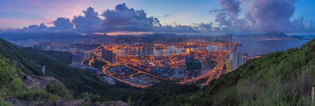
The Tsuen Wan new town’s planned geography crosses today’s district boundaries, joining factories, container terminals and new communities.
A town planned across three places
Factories and a port on the same map
Tsuen Wan grew as an industrial area. Many factories later moved across the border, yet the region retained an industrial character. In Kwai Tsing, nine container terminals occupy another working stretch of waterfront. Housing, factories, transport links and cargo facilities therefore belong to the same wider story of planned growth.
A regional project, distinct neighbourhoods
The new-town map explains why these places are often discussed together, while the district map identifies their present administrative boundaries. Kwai Chung and Tsing Yi are not merely extensions of Tsuen Wan: their container-port landscape gives the area a maritime role of its own. The contrast between planning scale and local identity is visible in the way the region is organized.