From the journal

Guilin Karst: Peaks, Depressions and Water

Guilin’s limestone landscape includes clustered hills, isolated towers and the water-shaped ground between them.

In the same city · Guilin ↗
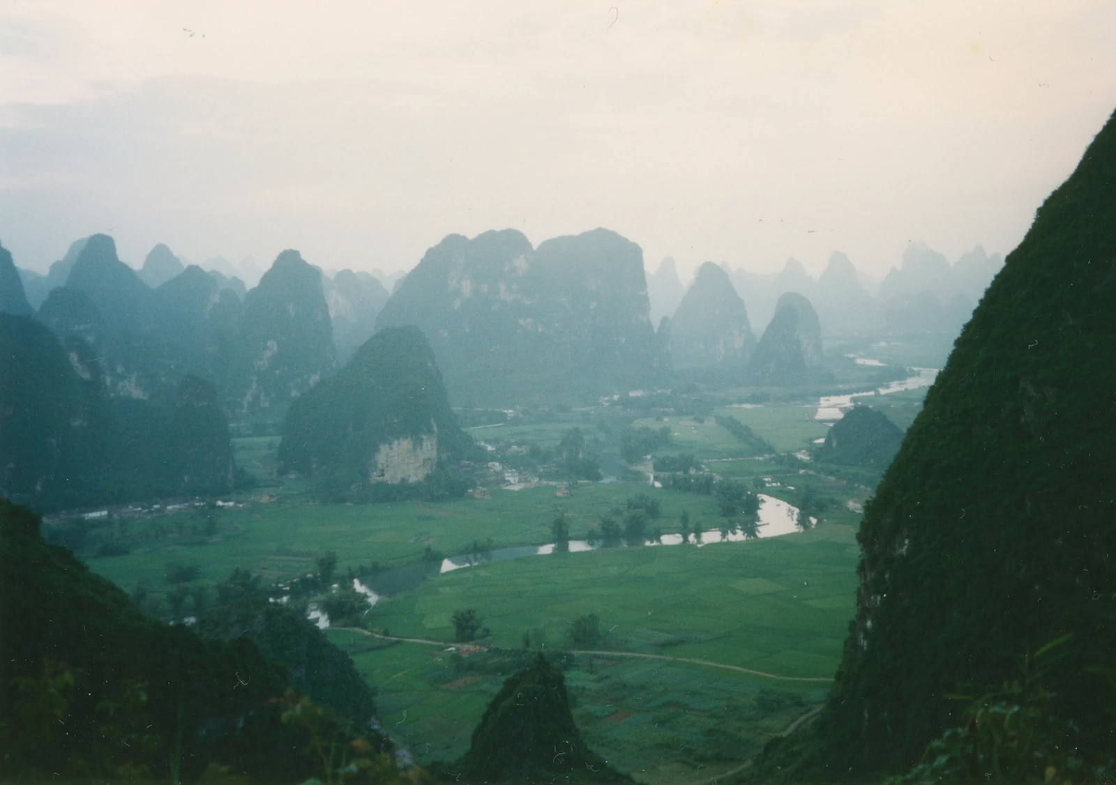
Cultivated fields and clustered karst peaks spread across the valley below Moon Hill.
The Yangshuo countryside seen from Moon Hill in a film photograph dated June 1995.

Peak clusters and peak forests

Geomorphologists distinguish Guilin's terrain through the relationships between summits and the ground around them. Connected hills can enclose depressions; isolated hills rise from a comparatively level plain.

Chinese terminology gives these forms names. Fengcong describes peak clusters associated with depressions; fenglin describes peak-forest terrain, with individual hills rising from a comparatively level surface. The space between the mountains is part of the landform.
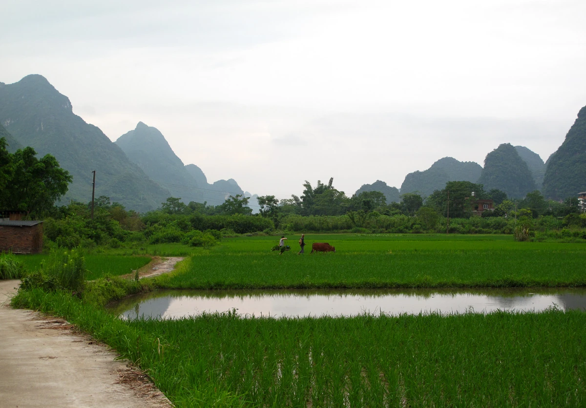
Rice fields, a narrow water channel and distant people lie below Yangshuo’s karst hills.
Cultivated fields in the Yulong valley near Yangshuo, showing the landscape as agricultural space. Source-reported photograph date: 2017-06-27.

The missing rock matters

Karst develops through the dissolution of soluble rock. In the Guilin basin, water, limestone structure and drainage have interacted over geological time. Hills remain as high ground within that process, while the lower spaces record removal and change.

Geologist Tony Waltham emphasises the role of water and sediment entering from neighbouring sandstone terrain. Rivers, sediments and underground drainage connect the limestone landscape with ground beyond it, making the basin a changing system.

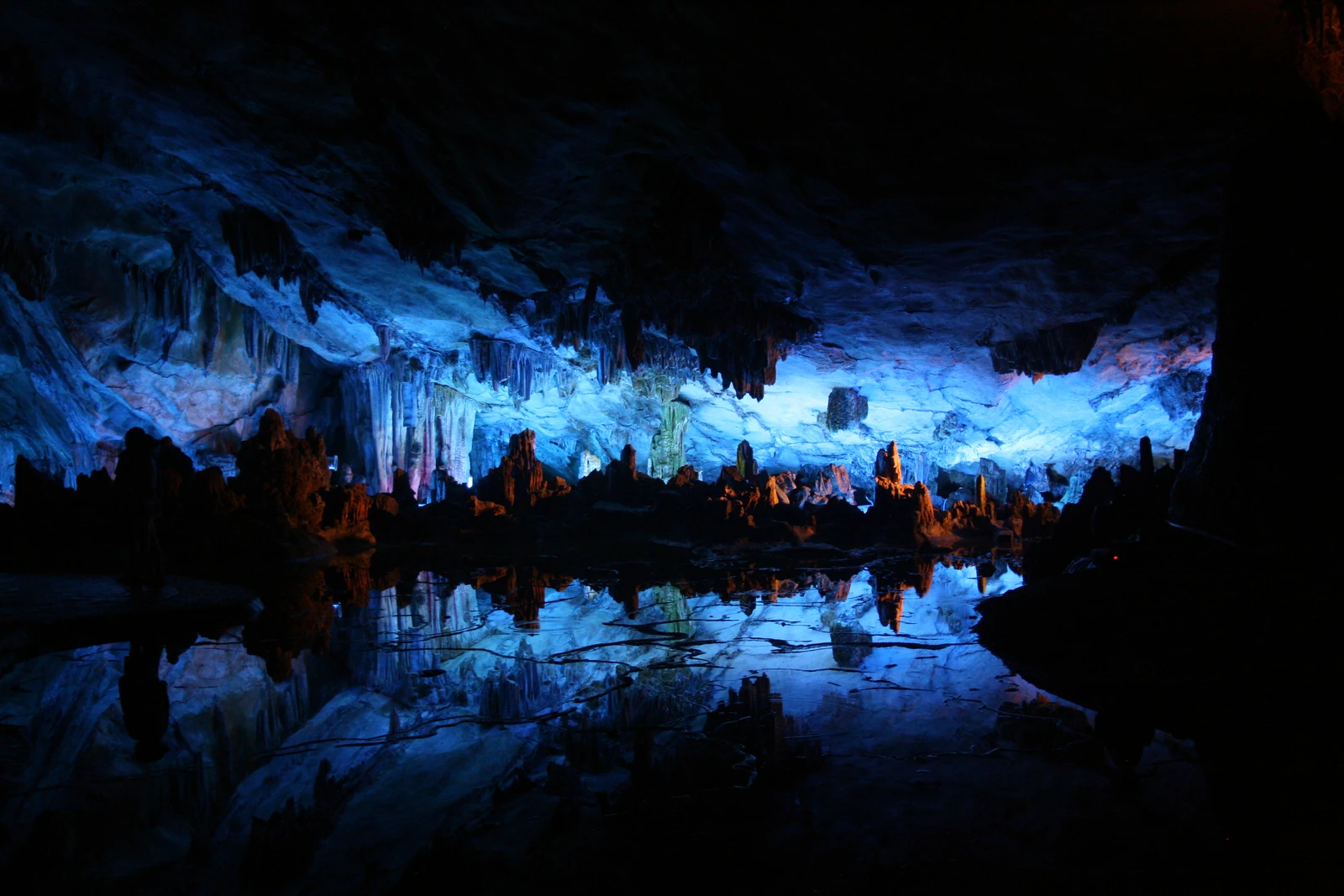
Blue artificial light illuminates limestone formations reflected in a cave pool.
Reed Flute Cave in Guilin, with artificial visitor lighting, photographed on 19 July 2009.

A landscape with intermediate forms

The two familiar labels do not divide every view cleanly. A 2019 terrain-analysis study by Xianwu Yang and colleagues distinguished typical fenglin, fengcong and chains of connected peaks. Its method considered summits, saddles and the presence or absence of enclosed depressions. A short line of linked hills need not be equivalent to a cluster enclosing a hollow.

A roadside view may conceal the ground behind a hill, leaving too little information for classification. A photograph compresses distance and can make separate hills appear joined; terrain analysis therefore compares patterns of summits, saddles and depressions.

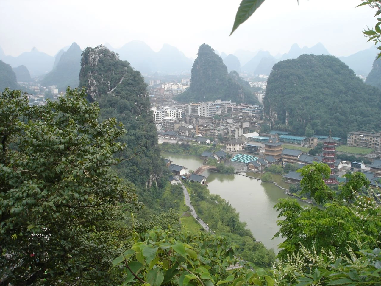
Guilin’s buildings, water and wooded hills spread below Folded Brocade Hill.
Historical city view of Guilin from Folded Brocade Hill, photographed in 2006. Source-reported photograph date: 2006-06-04.

Why scientists compare whole patterns

A study published in Geological Quarterly compared seventeen areas in Guilin and Huanjiang using numerical measures of landform pattern, including how much of an area the relief occupied. Such work tries to describe differences that scenic adjectives cannot capture. Mixed landscapes matter as much as ideal textbook examples.

A protected landscape has edges and connections

Guilin joined the South China Karst World Heritage property in its 2014 extension. The designated sections are Putao and Lijiang, within a wider city and regional landscape.

UNESCO stresses protection of catchments and their underground connections. Water moving through that wider terrain links the celebrated skyline with river margins and less conspicuous ground. The landscape's geological relationships also shape the scale of its conservation.

Continue exploring · Guilin Karst ↗
Photo credits and rights
  1. Historical film photograph of the Yangshuo countryside from Moon Hill, dated June 1995. It records an earlier landscape rather than present-day conditions.Arian Zwegers · CC BY 2.0 Photo source ↗ Rights information ↗ Resized and converted to WebP; full composition retained.
  2. Cultivated fields in the Yulong valley near Yangshuo, showing the landscape as agricultural space. Source-reported photograph date: 2017-06-27.Rutger van der Maar · CC BY 2.0 Photo source ↗ Rights information ↗ Resized and converted to WebP; full composition retained.
  3. Reed Flute Cave in Guilin, with artificial visitor lighting, photographed on 19 July 2009.Bernt Rostad · CC BY 2.0 Photo source ↗ Rights information ↗ Resized and converted to WebP; full composition retained.
  4. Historical city view of Guilin from Folded Brocade Hill, photographed in 2006. Source-reported photograph date: 2006-06-04.Klobetime · CC BY-SA 2.0 Photo source ↗ Rights information ↗ Resized and converted to WebP; full composition retained.