From the journal

Lulang Forest in the Summer Cloud Belt

Lulang’s forest belongs to the Bayi District mountain landscape, where rain, mist and elevation make Nyingchi’s seasonal vocabulary more than a spring blossom story.

In the same city · Nyingchi ↗
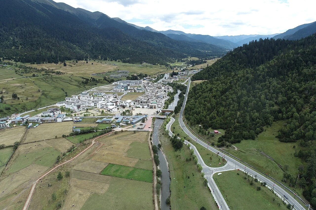
Aerial view of Lulang Town and its road in a mountain valley
Lulang Town, photographed 22 September 2024. Photo: Zhangmoon618, CC BY-SA 4.0.

A forest best read beyond the blossom season

Lulang Forest is often folded into the springtime image of Nyingchi, yet the city tourism authority’s seasonal account gives summer a different vocabulary: rain and cloud moving into the region, and the forest becoming a landscape of green. It names Lulang in Bayi District alongside Gangyun Spruce Forest in Bomi and Motuo’s vertical ecological zones. The distinctions matter: Lulang is a named forest destination in its own district, not a stand-in for all of Nyingchi’s forests.

The tourism account also describes the municipality as a meeting place of mountains, rivers and forest. Its language is promotional, but the geographic profile supplies a firmer frame: Nyingchi’s terrain drops sharply from high ranges into river valleys, and its rivers include the Nyang and Parlung Tsangpo. Lulang’s forest scenery belongs to that larger relief.

A vertical landscape, not a single green wall

Nyingchi’s geography changes rapidly with height. The municipal profile says snow and ice landforms dominate above 4,800 metres; permafrost and frost-shaped terrain are prominent from 3,800 to 4,800 metres; and running water and sediment processes dominate below 3,800 metres. These bands describe the region, not a plot-level survey of Lulang, but they help explain why a forest view can sit beneath snow-bearing ridges and beside sharply incised valleys.

The tourism authority’s seasonal overview places Lulang in summer’s forest chapter. Seen together, the sources invite a more precise way of looking: notice the canopy, then the slope above it and the water route below. The forest is one layer in a high-relief environment, with weather and altitude shaping how the landscape appears through the year.

What a photograph can hold

The selected photograph is an aerial view of Lulang Town, dated September 2024. Its road and settlement lie within a mountain valley, a more inhabited frame than the forest panorama implied by the destination’s name. The tourism authority’s account describes spring, summer, autumn and winter as distinct visual seasons across Nyingchi, but this image records one townscape at one moment.

That is part of Lulang’s appeal as a place to read slowly. Forest is not merely a green color on the map; it is a living edge between valley weather and higher mountain ground. The photograph begins with a settlement, while local geographic records help situate it within the district’s ridge-and-river terrain.

Continue exploring · Lulang Forest ↗
Photo credits and rights
  1. Lulang Town, photographed 22 September 2024. Photo: Zhangmoon618, CC BY-SA 4.0.Zhangmoon618 · CC BY-SA 4.0 Photo source ↗ Rights information ↗