From the journal

Chamdo: A City Read from River and Hillside

At the meeting of the Ngom Chu and Zha Chu, Chamdo’s riverside streets, raised monastery and upper viewpoints reveal a city built across changing levels.

In the same city · Chamdo ↗
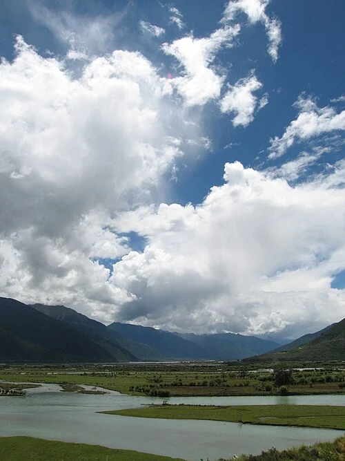
River valley south of Chamdo town
The valley south of Chamdo town, 24 August 2007. Photograph: Jaryiah Khan; CC BY-SA 3.0. This is a historical landscape photograph.

Begin with the rivers

Chamdo’s urban centre occupies the meeting of the Ngom Chu and Zha Chu, with the Lancang continuing through the valley. Water divides and connects the built ground. From above, the river helps organise the eye, turning blocks of buildings and stretches of road into parts of a larger shape.

The mountains are close enough to remain present in the city’s views. Buildings occupy the lower ground, while routes rise toward religious sites and viewpoints. A change in height quickly changes the relationship between foreground and distance: what appeared as a street becomes one line within a valley.

Jampaling supplies a higher reference

Jampaling monastery stands above the confluence. Its halls and courts belong to a different scale from the commercial lanes below, but the two settings are closely connected. The monastery provides a reference visible from the city, while nearby streets accommodate shops and everyday movement.

A March 2025 report describes the area through dairy stalls, fresh vegetables, household goods and small food businesses. Those observations give the monumental view a lived setting. People can be concerned with shopping or a meal while moving within a landscape shaped by an important religious institution.

Height reveals the whole; streets reveal its parts

The same report describes the city from the Binguo viewpoint, with the river running among buildings and mountains beyond. This elevated perspective gathers places encountered separately at ground level into one composition. It makes the terrain and the concentration of construction easier to understand together.

Returning attention to the streets adds what a panorama leaves small: a doorway, a market stall, a public square, someone carrying produce. Chamdo’s character lies in the relationship between these scales. Rivers and hills organise the city’s large form, while residents and daily work give its spaces their particular uses.

Continue exploring · Zhaqu–Angqu Confluence ↗
Photo credits and rights
  1. The valley south of Chamdo town, 24 August 2007. Photograph: Jaryiah Khan; CC BY-SA 3.0. This is a historical landscape photograph.Jaryiah Khan · CC BY-SA 3.0 Photo source ↗ Rights information ↗