On September 12, 2017, Landsat 8 recorded Selin Co in natural color. The NASA Earth Observatory image is a wide, quiet view: turquoise and deep blue water fill an irregular basin, while pale ground and smaller lakes ring its edges. Seen from above, the lake’s scale, its branching shoreline and the dry plateau around it appear together in a single frame. Repeated images from a consistent viewpoint give researchers a way to return to large lakes across time. Here, one frame invites the eye to follow the water’s changing contours into the highland landscape around it.
From the journal
Selin Co: A Lake Seen from Space and Watched on the Ground
A 2017 Landsat image shows Selin Co in natural color. NASA’s account of a long satellite study places that striking view beside a measured change in summer blooms and the lake’s role as a wetland stopover for migrating birds.
In the same city · Nagqu ↗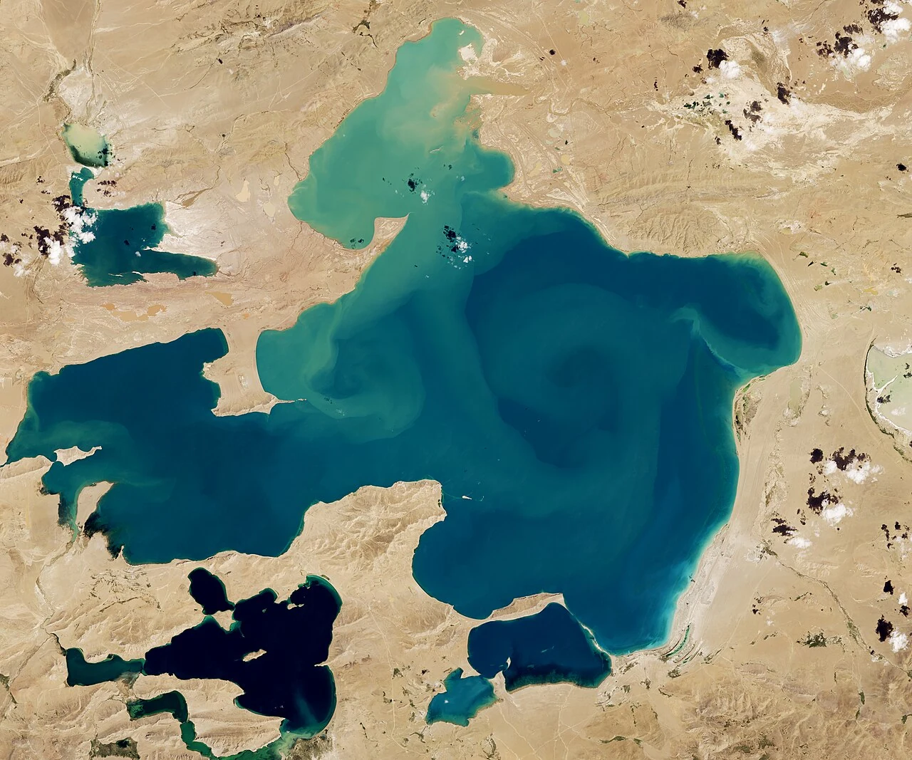
A lake in a satellite frame
What a long record can show
The image appeared with NASA’s explanation of a study by researchers from Stanford and NASA. They examined summertime conditions in 71 large lakes across 33 countries, using nearly 32,000 Landsat images spanning 1984 to 2012. The researchers tracked signals associated with chlorophyll-rich phytoplankton blooms. Across the 71 lakes, peak summer bloom intensity rose considerably in 48. NASA says Selin Co showed a steady increase in bloom intensity from 1995 onward. The result offers a long view of one lake within a global comparison, built from repeated observations rather than a single season. Its dates matter: the study follows a defined record through 2012, giving the 2017 image a broader research context.
Wetlands along a migratory route
NASA also places the lake within a wider living landscape. Its account identifies protected wetlands around Selin Co and describes the lake as a major stopover for birds migrating through the region. The shore and wetland setting connect water, grazing land and seasonal movement. The article notes that much of the land around the lake is used for grazing yaks, sheep and other livestock, and says this could contribute to blooms. That possibility places human use alongside the lake’s ecological patterns without reducing one to the other. The satellite view maps water and land at a broad scale; the migratory route gives that landscape a seasonal rhythm.
Reading the image with care
The frame rewards two kinds of attention: the intricate shape of a highland lake on one day and a change traced across many summers. NASA’s study follows bloom intensity through 2012; the image preserves the lake’s form in September 2017. Read together, the dates give the scene depth. The shoreline is not simply a border around water. It belongs to a wetland landscape where wildlife pauses, pastoral households use surrounding land and researchers study patterns from above. Selin Co comes into focus through both the visible detail of its shores and the longer environmental record that gives those details a story.