A 2025 account from Luolong County introduces Shuodu as a historic town on the Tea Horse Road. It also records an older name, Shuobanduo, glossed in the source as a “dangerous fork.” The phrase evokes a place defined by passage and choice, though the report does not supply a linguistic study of the name. What it does give is a local chronology: grain shops are associated with the Yuan period, and a Qing garrison later left traces in the town. Shuodu’s history is presented not as one intact monument, but as layers attached to a route.
From the journal
Shuodu: A Tea Horse Road Town Remembered in Layers
A 2025 county account follows Shuodu from an old caravan station to its surviving walls, Qing-era garrison traces and a former lodging place of the 18th Army. A village tree story remains oral memory, not a dated historical record.
In the same city · Chamdo ↗
A name that remembers a difficult crossing
Walls, graves and a place to lodge
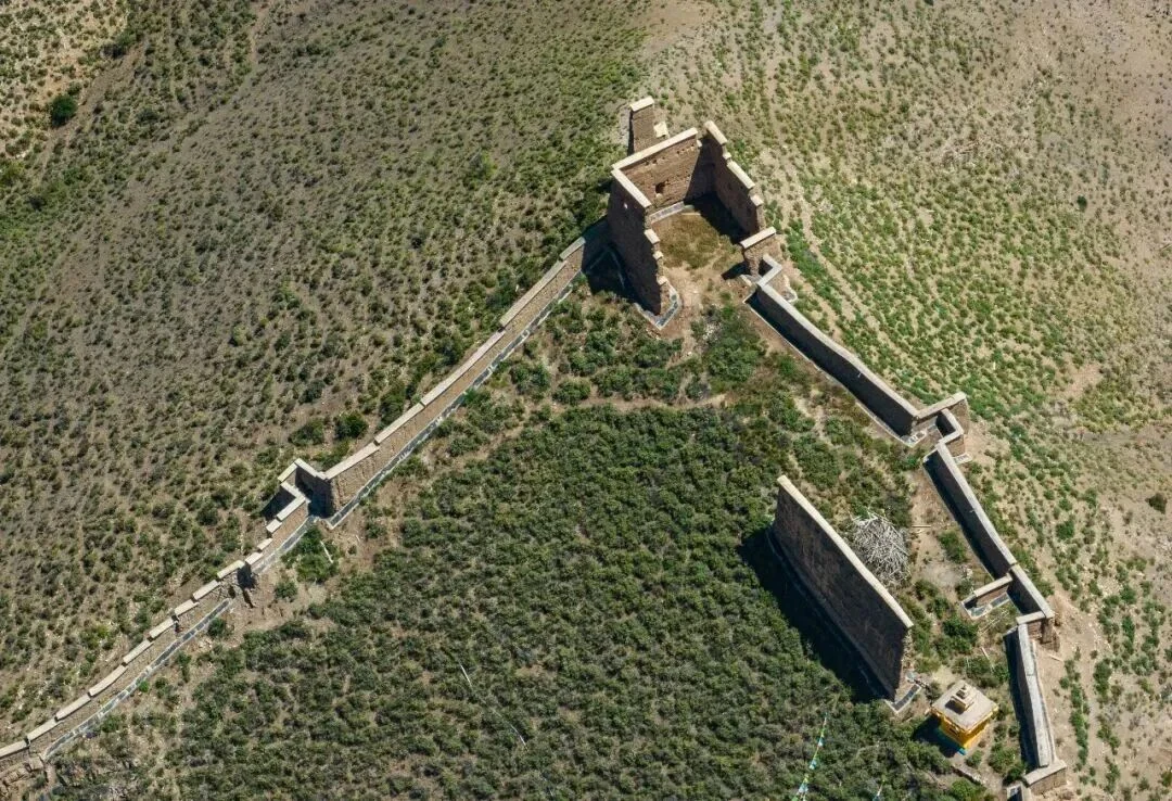
The county account lists old walls, Qing graves and a site associated with lodging by the 18th Army. Each kind of remnant speaks to a different use of the town: defense, burial, and temporary occupation. The report does not date every wall or identify the circumstances of each stay, so they should not be folded into one continuous story. Their coexistence is still telling. A settlement along a route can gather infrastructure for movement, authority and everyday life, with later periods leaving marks beside older ones. The physical traces make Shuodu legible as a place repeatedly used rather than simply passed through.
The union tree and a village telling
The same account describes a tree known locally as a union tree and preserves a story about its planting: an early couple from different ethnic backgrounds planted it, and later couples came to pray there. This is a community story as reported in 2025, not an independently dated event or proof of the tree’s age. Its meaning lies in the way the account connects the tree to marriage and social ties. It places living memory beside walls and graves, but the two forms of evidence are different. The former is an attributed oral narrative; the latter are physical remains summarized by a county source.
A town shaped by passages
Shuodu’s story is easiest to read when its elements remain distinct. A Tea Horse Road station speaks to circulation; grain shops point toward exchange and supply; garrison traces signal state presence; a lodging site recalls a more recent military journey; and the tree story gives the town a social memory of union. The 2025 description does not resolve every date or provide an archaeological survey, but it offers a useful guide to what the town contains and how residents explain one landmark. In a valley settlement, history can survive as both masonry and telling, each asking a different kind of question from the visitor.