Laigu village in Basu is associated with a group of glaciers and the lakes formed in front of them. A 2026 study in the National Remote Sensing Bulletin takes a more specific view, examining Gongcuo and Langcuo near the fronts of Yanong Glacier and the Laigu glacier group. It distinguishes Gongcuo as an ice-contact lake and Langcuo as more independent and enclosed. These are not interchangeable blue surfaces: their relation to ice and drainage gives each a different setting for observation.
From the journal
Laigu’s Glacier Lakes, Seen Through a Year of Freeze and Thaw
A 2026 remote-sensing study compared two lakes near Laigu village over one year, showing how seasonal freezing can change the boundaries that satellite radar detects. A 2022 blessing photograph offers a separate, dated human scene at the glacier.
In the same city · Chamdo ↗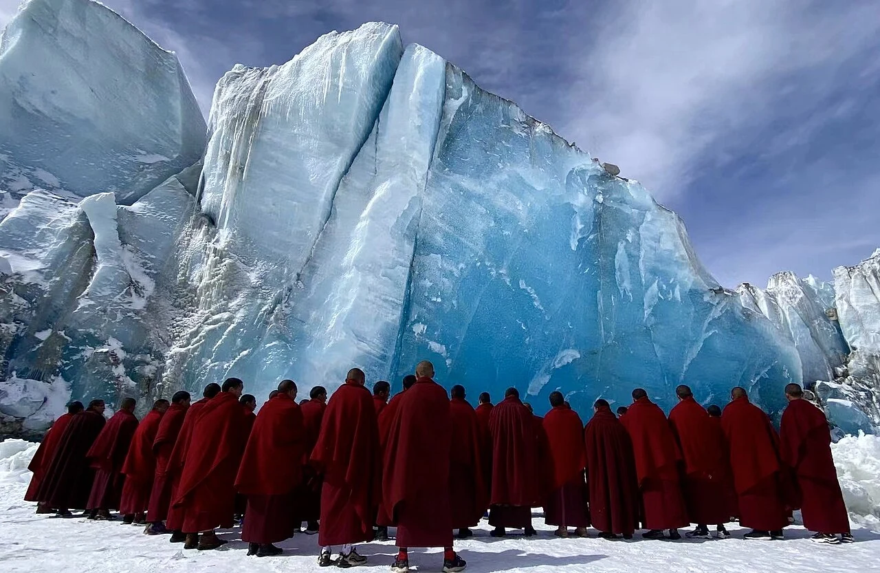
Two lakes beside a glacier village
Radar boundaries change with the season
The research combines Sentinel-1 synthetic-aperture radar with optical imagery to examine mapped lake-area changes during 2020. Seasonal freezing and thawing affect how accurately radar separates water from surrounding surfaces. Gongcuo’s SAR-derived area ranged from 1.85 to 2.65 km², while optical imagery showed 2.6–2.8 km²; Langcuo’s estimates were more stable. At Gongcuo, relatively stable lake ice from November through March helps explain the difference between the two mapping methods.
What a satellite measurement means
Synthetic-aperture radar is useful when weather or light complicates ordinary imaging, but its signals still need interpretation. Ice, wet ground and open water return different signals, and their boundary is not always clear. The Laigu study pairs radar with optical imagery to distinguish open water from stable ice. At Gongcuo, lake ice from November through March masks the open-water signal in radar, helping explain why the SAR-derived area can fall below the optical estimate. The mapped outline is a seasonal classification of surface conditions, not a direct gauge of water level.
A human scene belongs to its own date
A separate 2022 photograph selected for this article shows monks at a blue glacier during a blessing ceremony near Laigu. It captures a particular event, not a timeless custom or a measurement of glacier change. Keeping the image’s date visible allows the scene to sit beside the satellite study without pretending that ritual and remote sensing answer the same question. One records people gathered at an ice front on a day in 2022; the other compares lake boundaries across seasons in 2020. Together they make the place legible through two carefully distinguished kinds of evidence.